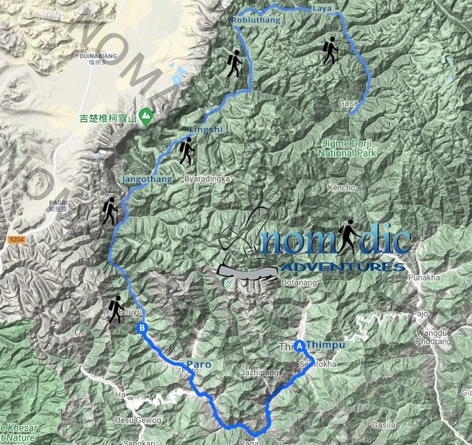
Laya Ghasa Trek
most scenic area of Bhutan
most scenic area of Bhutan
The Laya Ghasa trek in Bhutan is like nowhere else in the Himalayas.
is considered one of the most scenic treks in Bhutan, offering amazing
views of some of the most pristine and unspoiled landscapes
It
takes you through the isolated, unique and traditionally rich villages
of Chebisa and Laya, passing through several nomadic campsites.
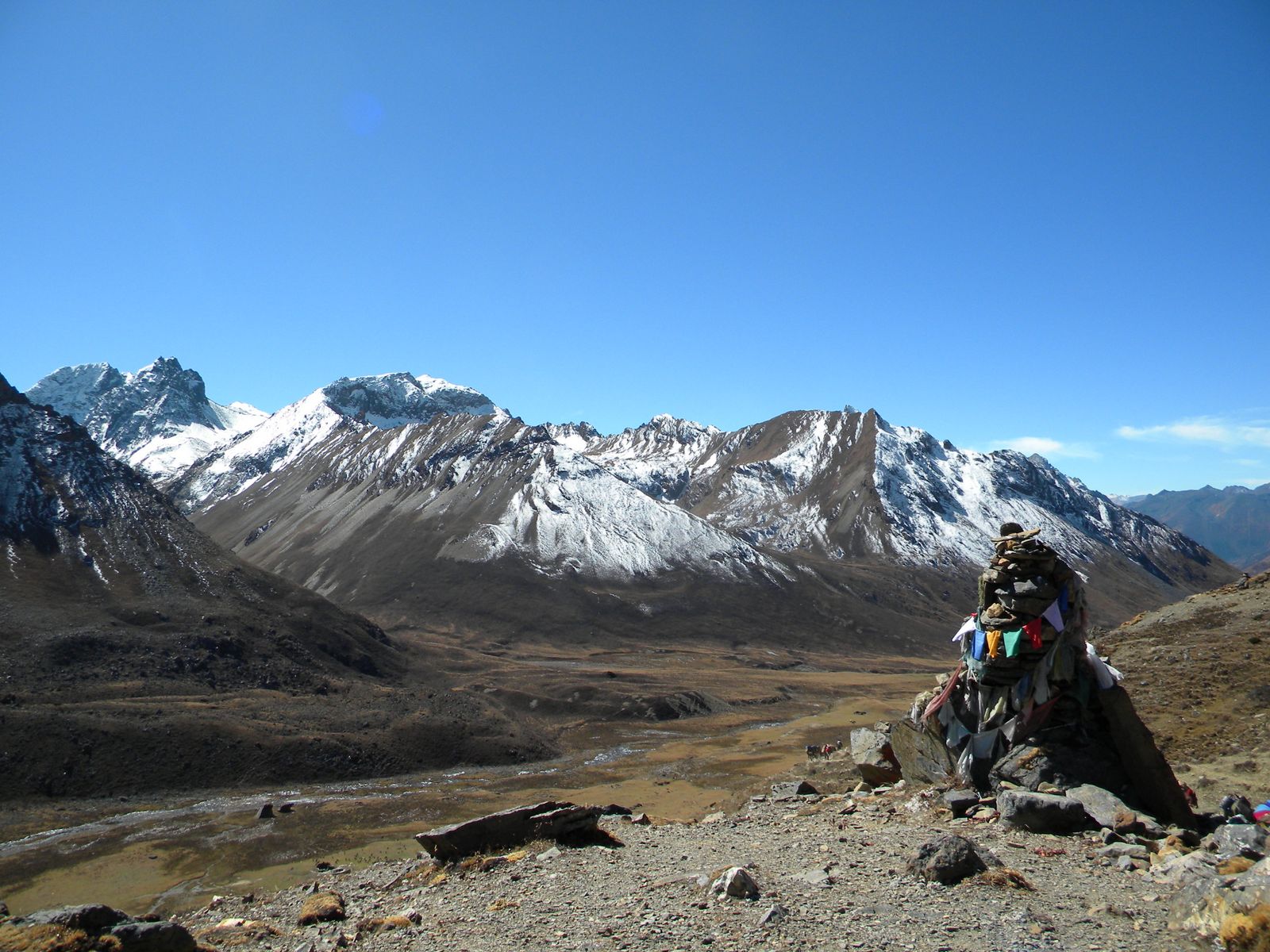
Along the trail you'll be able to spot indigenous animals
such as blue sheep and Takins, the national animal of Bhutan.
You'll travel through remote mountain villages inhabited by
Layaps (people of Laya),
a distinct segment of the Bhutanese society with unique culture,
traditions and appearance. The trek is one of the more difficult
treks offered in Bhutan due to the high altitudes and steep ascents and
descents along the path.

Day-1: Arrival Paro (By Druk Air).
Day-2: Paro Day hike to Taktsang monastery
Day-3: Paro - Shana [17 Kms, 5/6 Hours]
Day-4: Shana - Soi Thangthangkha [20 Km, 7/8 Hours]
Day-5: Soi Thangthangkha - Jangothang [19 Km, 7/8 Hours]
Day-6: Rest Day At Jangothang
Day-7: Jangothang - Lingshi [18 Km, 7/8 Hours]
Day-8: Lingshi - Chebisa [10 Km, 5/6 Hours
Day-9: Chebisa - Shomuthang [17 Kms, 6/7 Hours]
Day-10: Shomuthang - Robluthang [18 Kms, 6/7 Hours]
Day-11: Robluthang - Limithang [19 Kms, 7/8 Hours]
Day-12: Limithang - Laya [10 Kms, 4/5 Hours]
Day-13: Rest Day At Laya
Day-14: Laya - Chamsa [19 Kms, 8/9 Hours]
Day-15: Chamsa - Gasa Tshachu [14 Kms, 6/7 Hours]
Day-16: Gasa Tshachu Rest Day
Day-17: Gasa Tshachu - Damji [18 Kms, 5/6 Hours]
Day-18: Damji - Tashithang - Punakha[16 Kms, 5/6 Hours]
Day-19: Punakha - Thimphu
Day-20: Thimphu
Day-21: Thimphu - Paro
Day-22: Paro Depart
End of services
Day-1: Arrival Paro (By Druk Air).
 The flight into Paro is a brilliant introduction to the spectacular beauty of Bhutan. In clear weather, magnificent views of the world's highest peaks give way to the lush green Paro valley as you land. On arrival you will be met and driven to your hotel. Evening visit to Paro market and town. Overnight at the hotel in Paro.
Day-2: Paro day hike to Taktsang monastery
The hike which is all the way uphill takes about 2 /3 hours through villages and pine forests. The monastery clings to a huge granite cliff 800 meters from the Paro valley. Return to Hotel
Day-3: Paro - Shana [17 Kms, 5/6 Hours]
The trek starts from Drukgyel Dzong at 2580m with a short downhill walk on a wide trail. The trail climbs gently traversing through well maintained rice terraces and fields of millet. The route later enters an area of apples orchards and forests. Soon the valley widens and you reach the army post of Gunyitsawa at 2810m. This is the last stop before Tibet. At 2870m, just beyond Sharma Zampa, there are several good places in meadows to set up our tents surrounded by trees.
Day-4: Shana - Soi Thangthangkha [20 Km, 7/8 Hours]
The trail again follows Pa Chu (Paro River), ascending and descending through pine, oak and spruce forests. Hot lunch will be served after crossing the bridge towards the left side of the river. After lunch we follow the river and climb up through rhododendron forests and finally crossing the bridge again, reaching to an altitude of 3,750m.
Day-5: Soi Thangthangkha - Jangothang [19 Km, 7/8 Hours]
The path ascends for a while till you reach the army camp. We then follow the river above the tree line enjoying the views of the surrounding peaks. Hot lunch will be served inside a yak herder's camp. A short walk into the valley will take you to the camp at Jangothang at an altitude of 4,000m. From here, the view of Mount Chomolhari and Jichu Drake is superb.
Day-6: Rest Day at Jangothang
Enjoying the superb view around.
Day-7: Jangothang - Lingshi [18 Km, 7/8 Hours]
The trail follows the stream for half an hour and crosses the bridge to the right side. We start the climb up to the first ridge with breathtaking views of Chomolhari, Jichu Drake and Tsrim Khang. We then walk towards the valley before ascending to the pass at an altitude of 4700m. After the pass it's a gradual descent to the Lingshi camp, enjoying the panoramic view of the peaks and Langshi Dzong. Camp at the altitude of 4000m.
Day-8: Lingshi - Chebisa [10 Km, 5/6 Hours
Today is an easy day and pleasant walk through villages and yak herders camp. After lunch, a short walk will take you to Chebisa village. We stay by the side of stream at the altitude of 3850m.
Day-9: Chebisa - Shomuthang [17 Kms, 6/7 Hours]
Today begins with a steep climb up a ridge to Gubu la at an altitude of 4500m, taking nearly four hours. After the pass we descend to a lunch stop, through rhododendron bushes. Afternoon continue along the up and down path, after crossing the stream, through rhododendron forests and yak herders camp. You may see Blue Sheep now and then. Camp at altitude of 4,250m.
Day-10: Shomuthang - Robluthang [18 Kms, 6/7 Hours]
The trek starts with a climb to Jari la at the altitude of 4700m. Then descend to Tasharijathang valley, the summer residence of rare Himalayan Takin (national animal of Bhutan) From here we may have to cross the stream as most of the time the foot bridge is washed away. After crossing the stream towards the left, the trail ascends till we reach Robluthang at an altitude of 4200m.
Day-11: Robluthang - Limithang [19 Kms, 7/8 Hours]
It's a long climb up to Shinje la pass (altitude 4900 m). The view of the mountains from the path is stunning. After the descend to Lemithang. The path is quite narrow and you may have to cross stream again and get wet. The last part of the trek is very interesting with the view of Mount. Gangchey Ta peak. Arrive at the site at the altitude of 4100m.
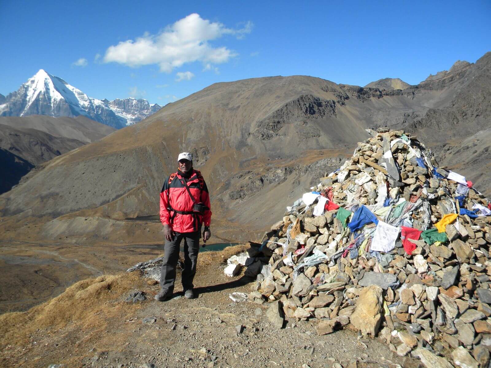
Day-12: Limithang - Laya [10 Kms, 4/5 Hours]
In the morning you wake up with a superb view of Gangchey Ta peak in front of you. The walk to Laya is very pleasant with wonderful views. You will pass through a camp forest, filled with moss and singing birds. Arrive at Laya village, the second highest settlement in the country, at the altitude of 3800m.
Day-13: Rest Day At Laya
Explore the village.
Day-14: Laya - Chamsa [19 Kms, 8/9 Hours]
Descend to army camp and join the Mo Chu (mother river of Punakha). Follow the river till you cross the bridge. After the bridge it is up and down several times, through juniper and fir forests until you reach the camp at Chamsa at an altitude of 3800m.
Day-15: Chamsa - Gasa Tshachu [14 Kms, 6/7 Hours]
Walk for about half an house over flat land till the Bele la pass. Its down hill all the way to Gasa Tshachu. Lunch at Gasa village at the altitude of 2700m. After lunch visit the village and Dzong. The Dzong was built in 17th century by the first religious King, Shabdrung Ngawang Namgyal, to protect the valley against Tibetan invaders. Then proceed to Gasa Tshachu (hot spring) for camp at an altitude of 2200m.
Day-16: Gasa Tshachu Rest Day
After a long trek, this is the place to relax.
Day-17: Gasa Tshachu - Damji [18 Kms, 5/6 Hours]
The path continues ascending and descending through heavily forested areas and wild orchids. In this area, there are leeches so one must be careful. Camp nearby the village at an altitude of 2400m.
Day-18: Damji - Tashithang - Punakha[16 Kms, 5/6 Hours]
It is the last trekking day. Continue following the Mo Chu river down through heavily forested area till you reach Tashithang at an altitude of 1,620m. Connecting Horizons Adventures transport will be waiting to drive you at Punakha (15 kms), following the river all the way. Overnight at the hotel in Punakha.
Day-19: Punakha - Thimphu
Morning sight seeing in Punakha and Wangdiphodrang valleys visiting Dzong and the local market. Afternoon drive to Thimphu. Overnight at the hotel in Thimphu.
Day-20: Thimphu
Today city tour of Thimphu. Visiting Memorial Chorten, Tashichhodzong, National Library, Painting School, Traditional Medicine Institute, Handicrafts Emporium. Overnight at the hotel in Thimphu.
Day-21: Thimphu - Paro
Morning for shopping and at leisure. After lunch drive to Paro visiting Simtokha Dzong en route. Overnight at the hotel in Paro.
Day-22: Paro Depart
After early breakfast in the hotel, drive to the airport for flight to onward destination.
End of services
No, this is a camping trip so you cannot.
All meals on trek are prepared for by the support team. We can also cater for vegetarian and any other dietary requirements.
This is a really difficult one to answer directly - "how will I cope with the altitude". To be honest, this is an ' unknown' factor as no-one can predict how your body will cope at altitude. People who have been to altitude many times in the past without problems, may on one climb suddenly develop problems. There are many factors that play a role. The only way to help combat this, is to take all of the necessary precautions, and walk slowly.
Bhutan has ‘High Value, Low Impact' tourism policy to preserve its cultural heritages and environment. Thus, with a high rate, it welcomes responsible travelers and few visitors. The policy is built on a daily “visa” fee of US$250 during the high season (which runs March to May and September to November), and US$200 during the low season (all other months). The amount sounds alarming, but is actually a minimum spending requirement that includes meals, three-star (minimum) accommodations in city hotels or countryside resorts, land transport, and guide service for every day spent in the country.
If you are going hiking or climbing or trekking then you need extra cover for your activities. Hiking and Climbing have become popular for many adventure seekers looking to add a climb up Kilimanjaro or a trek to Everest Base Camp, Annapurna or even Island Peak to their list of amazing adventures. But any climb to high altitude carries with it a number of risks and having the correct and good trekking insurance is an absolute must. We recommend two different groups depending on which country you reside in. For further details, click here
The elevation gain is around 530m or 1700 feet so it is a substantial climb and takes around 5-7 hours in total. However it is well worth the effort. By doing this at the start of the tour it helps with acclimatisation.
As a traveler from USA, Canada, Australia, New Zealand you will need an adaptor for types C, E, F, D, M, G.
As a traveler from England you will need an adaptor for types C, E, F, D, M.
As a traveler from South Africa you will need an adaptor for types C, E, F, G.
Yes a visa for Bhutan is required for every foreign traveler and has to be processed by a local tour operator, as no foreign embassy abroad grants tourist visas. The visa cost is currently $40 and your passport must be valid for at least 6 months after you leave Bhutan.
Tap water is not safe to drink so you would need to buy mineral water which is readily available. Mineral water is readily available throughout the country. While on trek the guides will ensure that the water is boiled.
English is commonly spoken, as it is the medium of instruction in schools. The national and official language of Bhutan is Dzongkha. Road signs and government documents are written in English and Dzongkha, and the national newspaper is printed in English, Nepali and Dzongkha.